(Durovernum Cantiacorum - the enclosed settlement
of the Cantiaci by the alder swamp)
|
|
|
|
|
||||
|
Click on any thumbnail for a larger image |
|||||||
|
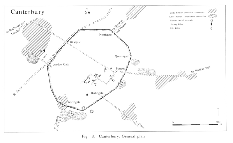
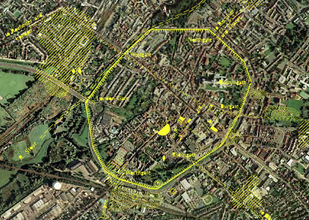
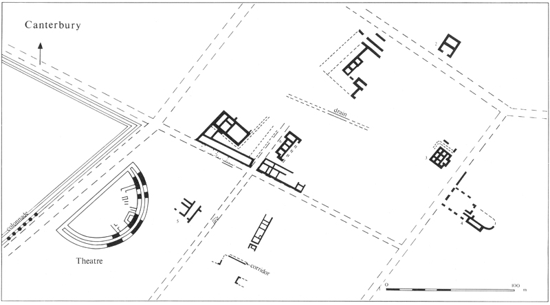
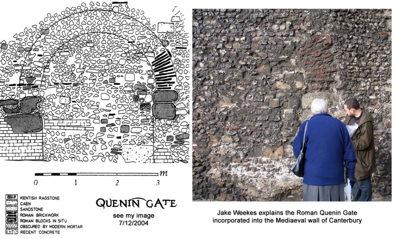
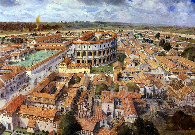
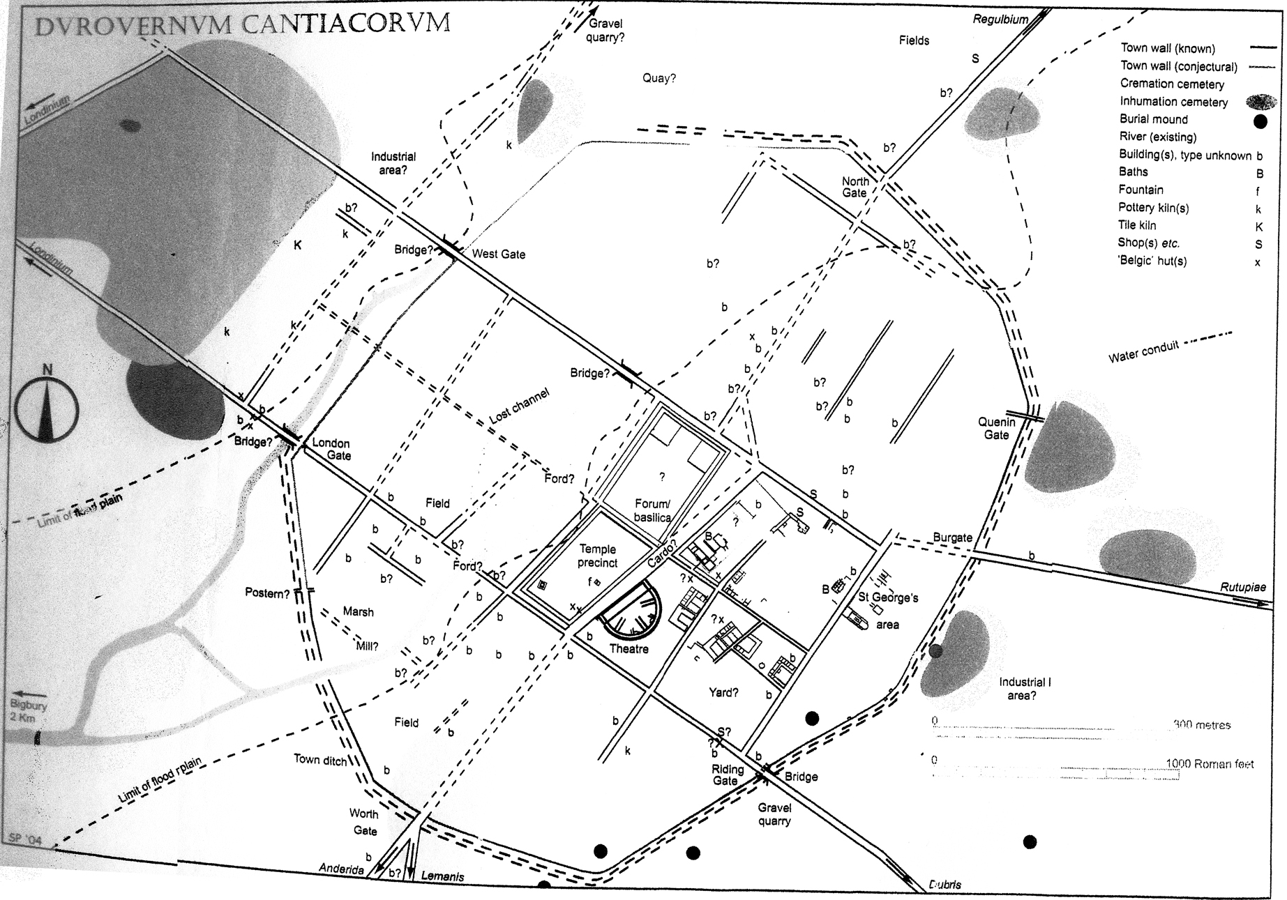
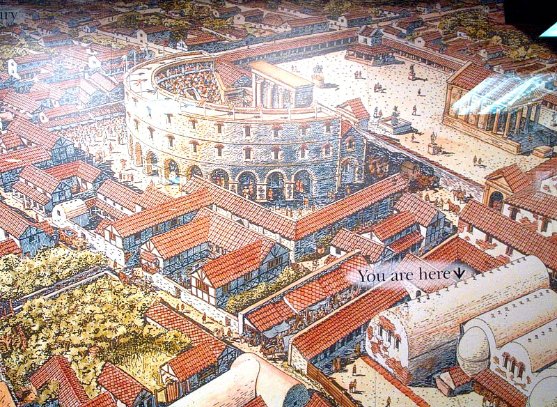
Origins First mentioned in the Antonine Itinerary (a kind of early road map) from the late 2nd Century, Durovernum Cantiacorum was the civitas capital of Romanised Kent. It is generally believed the first late Iron Age Belgic settlement was founded here shortly after Caesar's invasion of 55BC; with the locals routed by Caesar it appears that the oppidum on nearby Bigberry Hill was largely abandoned as its inhabitants moved to the site of present day Canterbury. Because Canterbury has been in continuous occupation since Roman times archaeology has been rather difficult and opportunities to dig are prized. From the evidence so far gleaned a map has been built up, albeit sparse, of Roman Canterbury. Click either of the images 1 & 4 here. [These maps are from Detsicas ca.1983.] The Buildings Archaeology has turned up not only Belgic ceramics as might be expected but also finds from the Claudian era. This indicates that the settlement was quite quickly developed by the Romans after Claudius' landings in AD43. The Roman bridgehead at Richborough would have been the main military base with supplies coming into Canterbury by road from Richborough at Burgate and more probably the River Stour at Fordwich (then North Gate) or even Canterbury if it reached the town. [Whether the river was navigable right up to the West Gate given that the area was described as an 'alder swamp' I don't know for I read somewhere that there was a Roman port at Sturry; one can speculate there may have been a wharf of some sort between the north and west gates since this is the most likely place for one.] So, looking at the plan of Canterbury after Detsicas '83 above we can see the regular, or not so regular, 'squarish' grid of the Roman town with 8 or 10 buildings, a couple of drains and a theatre of some sort. There is no evidence for an enormous military camp or fort (no real finds). Lack of lots of evidence of habitation means no real idea of how the town was except that the remains of a Belgic hut have been found indicating that it was still standing in AD60. A gradual demolition of Belgic structures being replaced by Roman ones is assumed. A theatre and baths have been found but not the exact position of the forum or basilica though these must have existed in the civitas. The theatre and associated buildings would have been built in Flavian times Agricola 21 funded by either the local tribal élite, Romans or, my personal guess, Gaullish merchants. The mediaeval wall copied the route of the Roman town boundary wall from the 3rd century (see image 2, overlay) so the gates are still visible but little of the insulae within the town have been found. Canterbury - Tutor Led Site Visit
The Theatre
The Temple Precinct No Roman town would be complete with a temple and its precinct, it was usually sited opposite the theatre. Evidence from other theatre sites suggests there would have been a view from the auditorium straight through the skene into the temple precinct. The precinct would be expected to be surrounded by a portico and be associated with a temple and a fountain, shrines and statues (remember the Romans fleeing to the temple in the destruction of Camulodunum and massacre of its residents?). Excavations over the years have indeed revealed large tracts of resurfaced gravelled surface; fragments of a Corinthian column, fluted drums and hundreds of pieces of Italian marble veneers put the temple plaza right here. The Basilica & Forum
The Public Baths
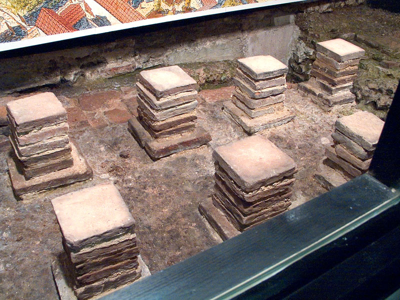
Town Housing From the plan (above right) it looks like Roman Canterbury had all the public spaces one might expect from a civitas: a theatre, basilica, forum, temple & baths and a square gird road system, or did it - for some reason not all the roads are at right angles. Most are and the insulae were probably in-filled with town houses. A transformation must have taken place in the 1st. century: circular houses with thatched roofs with wattle and daub or clay walls being replaced with rectangular timber framed dwelling and later, masonry houses of flint and mortar or ragstone and greenstone blocks all roofed with imbrices and tegulae tiles. Last stop on our walk then was the Roman Museum. The
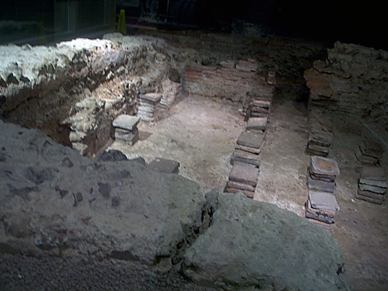
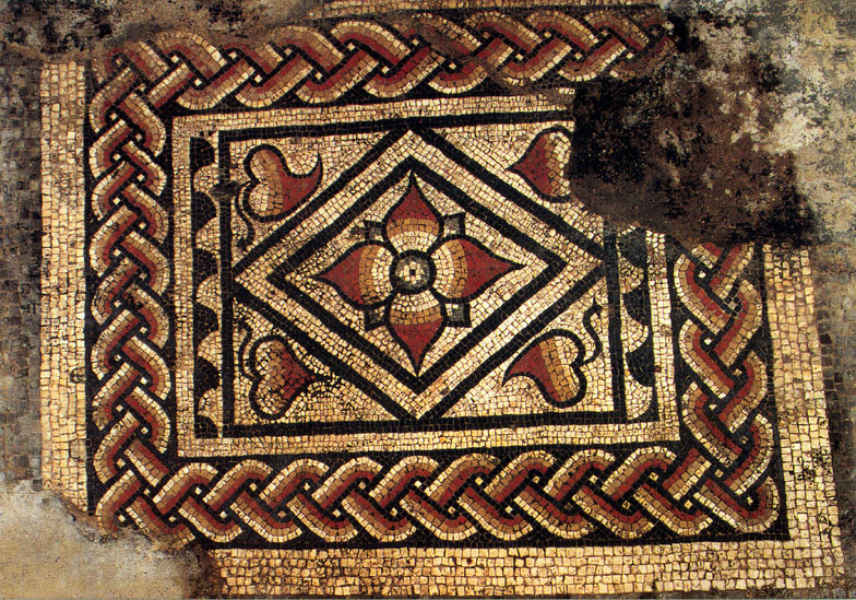
foundations of several town houses have been found in Canterbury they
are of the 'winged corridor' type and the most well known is that
underneath the Canterbury Museum in Butchery Lane. The building, dating
from the 1st century, was built of masonry and has been altered and
reconstructed over time and in its last manifestation had a hypocaust
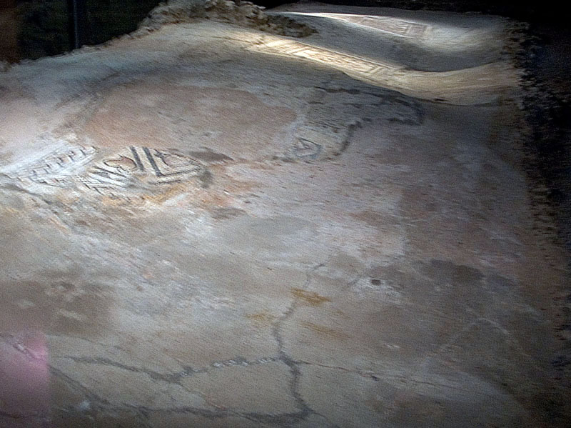
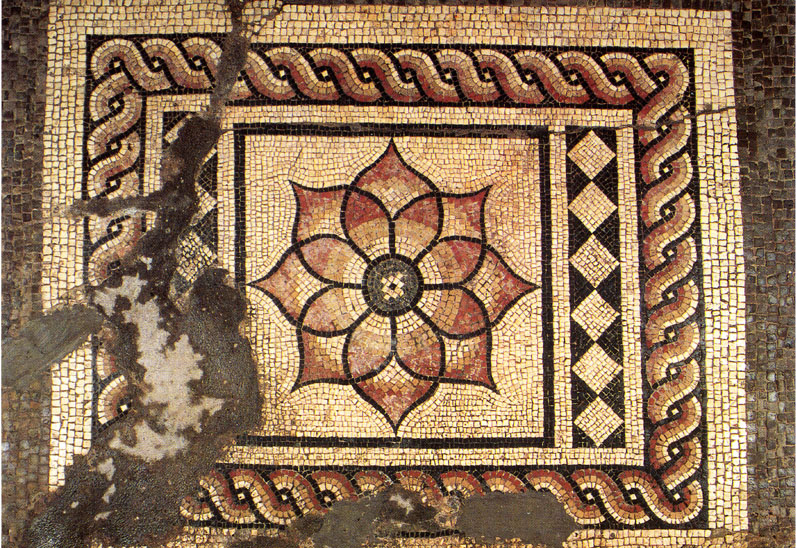
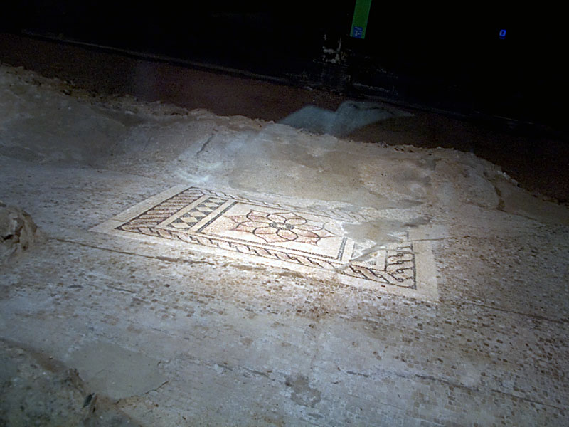
system, tessellated floors and extant mosaics. I have tried to
photograph the undulating floor of the house, my less than successful
images are below, the mosaics are scanned postcard views. (Tesserae:
black = Dolomitic limestone, red & yellow = pottery, white = marble.)
The museum has excellent displays of all sorts of finds showing all
aspects of Roman life. |
|||||||
|
Roman Museum - Longmarket House |
|||||||
|
|
|
|
|
|
|||
|
Click on any thumbnail for a LARGER image |
|||||||